
|
|
Lignières: Then and Now |
|
Move mouse over image for contemporary view; move mouse outside
for historical image.
If image doesn't change, click image to toggle between “then”
and “now” views.
The historical photograph is courtesy of M. Werner Löffel of Lignières, who kindly contributed images of his post card collection to the archives of the Fondation de l'Hôtel de Commune de Lignières.
|
by John Walker May, 2007 |
|
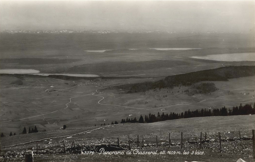
This panorama is taken from the Chasseral, the mountain whose 1607 metre summit (the figure in the “then” picture exaggerates slightly) is the highest point in the Canton of Neuchâtel. (For folks who think in Imperial units, this is almost precisely one mile above sea level.) The village of Lignières, situated on the Diesse Plateau at an altitude of 803 metres, is the northernmost commune in the canton.
The summit can be reached from Lignières by either foot path or automobile, and, when the weather is clear, provides magnificent panoramic views of the ancient Jura mountains of which it is the tallest, the Alps extending as far as Mont Blanc, the three lake region of Switzerland, and neighbouring France.
In this view, the village of Lignières is to the left of centre. It isn't terribly clear from this perspective, but just beyond the forest behind the village there is a steep downslope from the plateau at 800 metre altitude to the plain, where the lakes are situated, about 400 metres below. The leftmost body of water is the Lac de Bienne / Bielersee, about half of which is hidden behind the cliff. At the top centre is the Lac de Morat / Murtensee, and the northern end of the Lac de Neuchâtel (the largest body of water entirely within Switzerland) is at the right. The Alps are visible at the top of the picture, although as is often the case in less than perfect weather, it's a bit difficult to distinguish them from the clouds in which they are frequently shrouded.
I haven't been able to determine the approximate date of the post card. It is clearly before 1968, because that's when the road that bypasses the centre of Lignières, absent in the “then” picture, was built. There is a postmark on the address side of the card, but I haven't been able to decipher the year from it, nor have I been able to puzzle out the epoch from the presence or absence of buildings, but I hope to eventually do so in consultation with amateur historians of the village. Note how much the existing trees have grown and how many more trees there are in the “now” image—the forests are re-taking Europe!
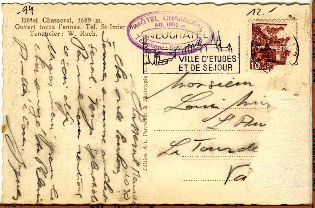
The post card was stamped by, and probably mailed at the Hôtel Chasseral which has been there since 1879 (it was entirely rebuilt after being destroyed by a fire in 1925), and still claims, precision cartography notwithstanding, to be 1609 metres above sea level.