ANTarcticaFourmilab South Pole ExpeditionJanuary, 2013 |
|
| 2013-01-04 20:23 UTC | Click images for reduced size. |
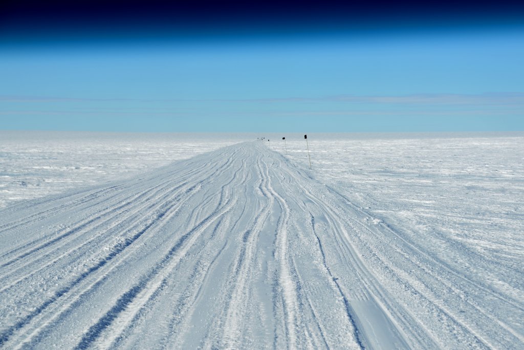
It's about an 8 km drive from the runway to the camp. Like all routes on the glacier, it is marked by flags and has been, at the start of the season, verified as being free of crevasses by a scan with ground penetrating radar. The blue cast at the top is due to the shading of the monster truck's windshield through which I took this picture: you're not looking at the top of the atmosphere! The altitude at Union Glacier Camp is only about 700 metres, 100 metres less than Fourmilab's home village of Lignières, Switzerland.
| 2013-01-04 21:43 UTC |
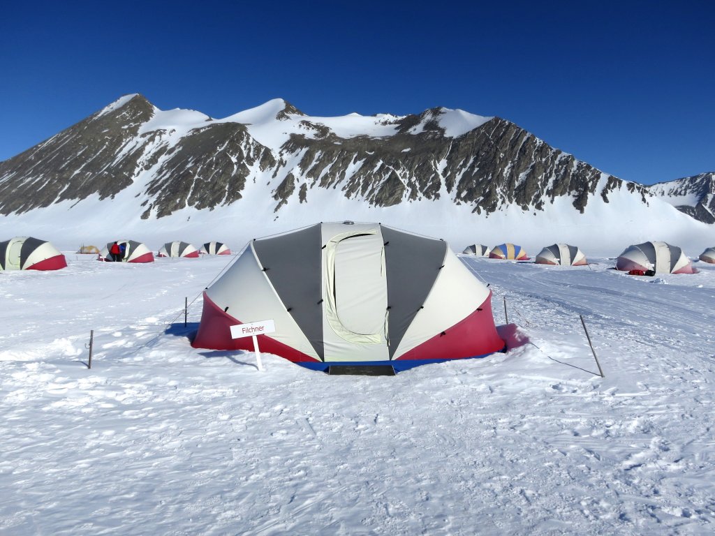
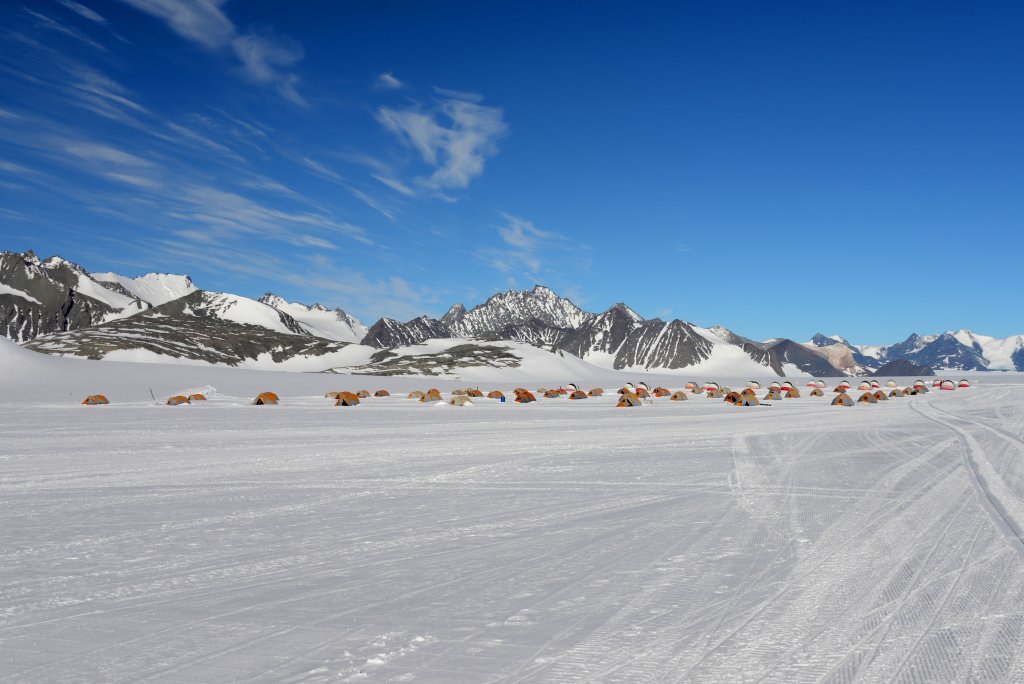
Our humble tent. 1450 metre Mount Rossman is in the background; it is a lot further away than it looks—the air in the Antarctic interior is so clear distances can be deceptive. Each tent is named after a polar explorer: ours after Wilhelm Filchner, who mapped the Antarctic coast in 1911–12.
| 2013-01-05 00:04 UTC |
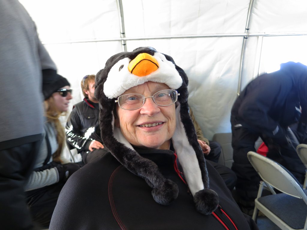
Initial briefing, R-person, and penguin hat.
| 2013-01-05 01:24 UTC |
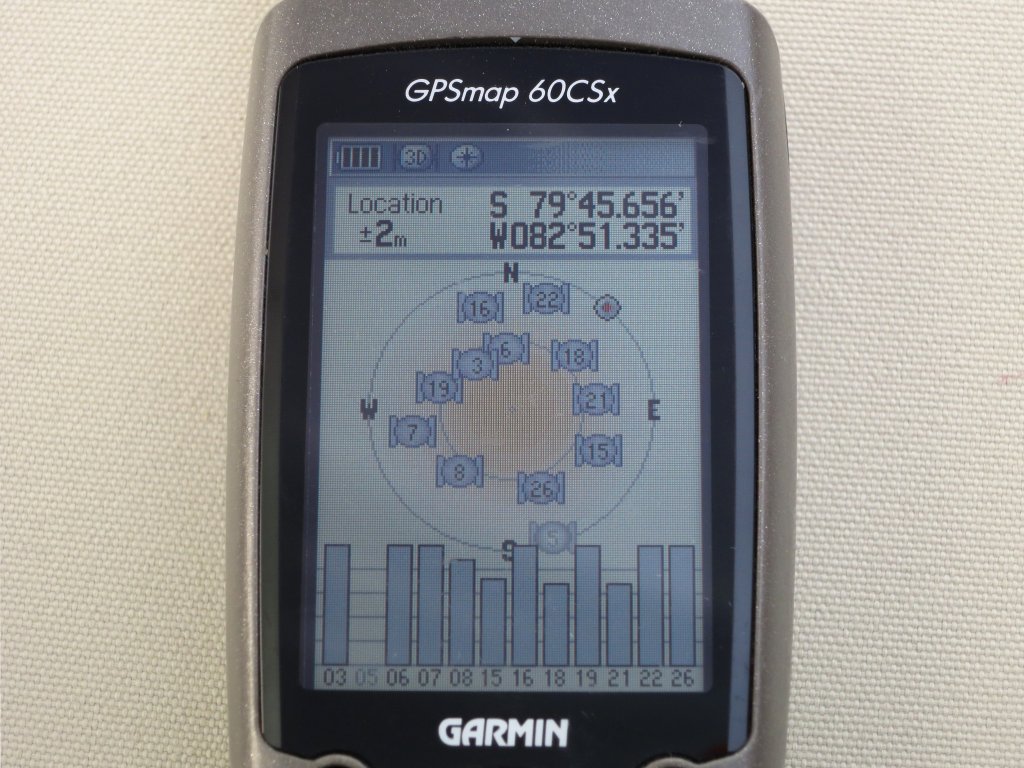
Union Glacier Camp: 79° South. I consistently got higher precision GPS measurements in Antarctica than I do in Switzerland—my guess is that it's due to GPS orbits in several planes converging toward the poles, as well as the unobscured skies rendering more satellites visible.
| 2013-01-05 23:47 UTC |
The Antarctic affairs desk, Filchner tent.
| 2013-01-06 16:26 UTC |
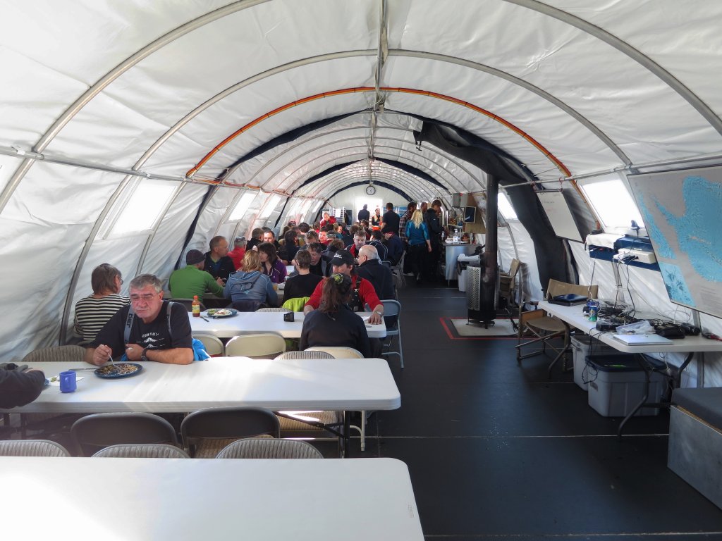
The mess tent is a gathering place not just for meals, but also briefings on the status of expeditions and schedules for excursions. Note the actinic light from outside. At right is a heater powered by a gas cylinder outside the tent. During our stay, it was warm enough in the tent that people often opened windows a bit.
| 2013-01-06 23:41 UTC |
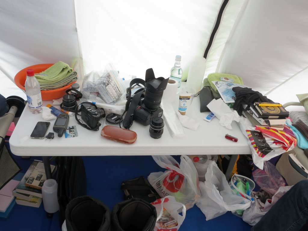
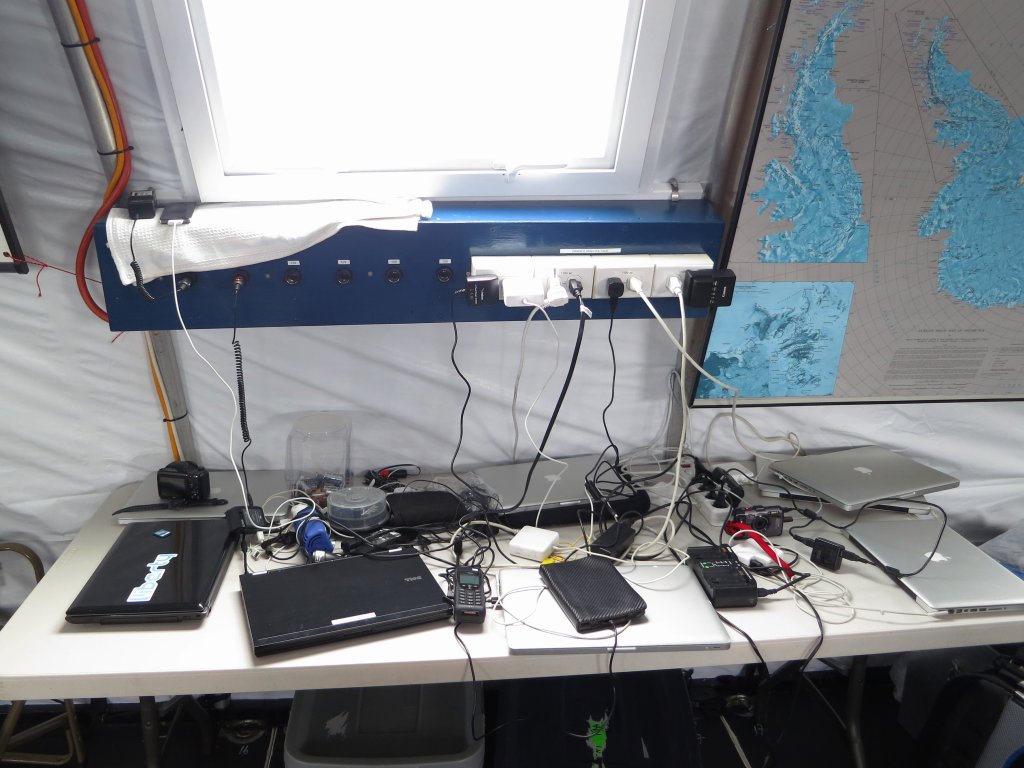
For those who've brought electronic gizmos, the charging station is a strong attractor. All solar powered, there are both quaint U.S. 120 volt and 12 volt “cigar lighter” outlets. I've never lit a cigar in my life, but having a plug and adaptor which allowed me to charge all of my batteries from this anachronistic round socket kept me all charged up during my time down south.
| 2013-01-07 14:46 UTC |
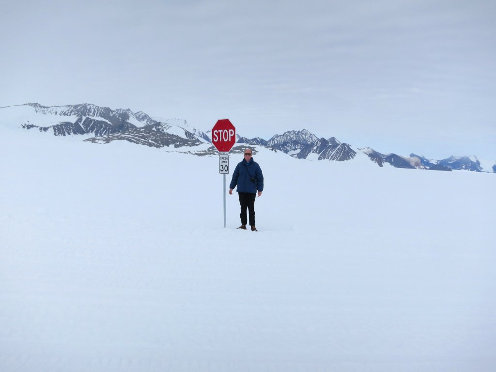
The stop sign at the bottom of the world. Actually, this stop sign makes sense: the track from the ice runway to the camp crosses the skiway for planes operating from the camp, so vehicles approaching the skiway are asked to stop and obtain clearance by radio before proceeding across it. In my experience, some do; some don't.

| 2013-01-06 14:14 UTC | Explore panorama in a new window. |
Here is a panorama (a bit more than 360°—you can see the Elephant Head on both sides) I made from images taken a bit beyond the stop sign. The variation in sky colour is because I took the photos with a circular polariser filter, which causes the darkness of the sky to vary depending upon the angle to the Sun. It's probably best to remove such a filter before making panoramas, but I don't think I'll be going back to try again. The panorama was assembled from 48 images taken with a Nikon D600 camera with the zoom lens locked to 28 mm focal length and a fixed exposure of 1/320 sec. at f/9. The images were merged into the panorama using the Photomerge feature of Photoshop CS4. You can explore the panorama as scrollable images in either large (7776×768 pixel) or monster (16384×1618 pixel) images.
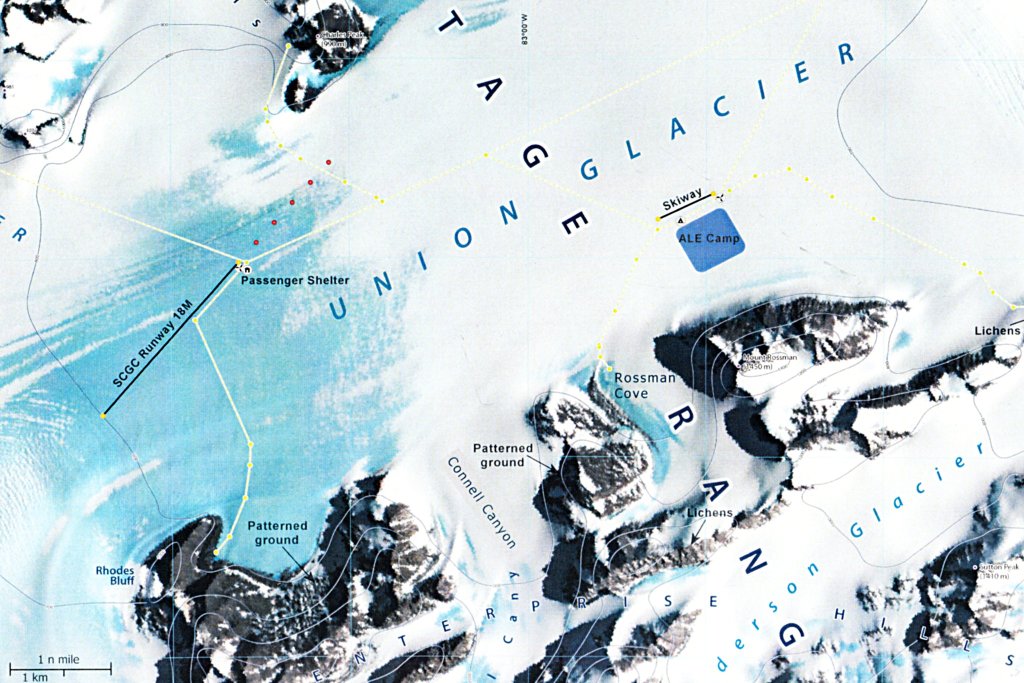
This is the official map of Union Glacier for the 2012–2013 season. Note the surveyed paths, marked in yellow, between the camp, the blue ice runway, and the various destinations we visited. The flow of the glacier is from lower left to upper right.
| 2013-01-07 15:15 UTC |
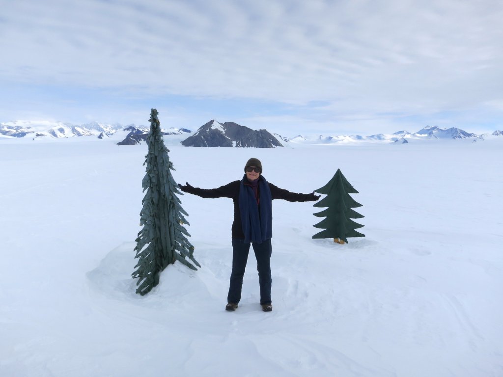
Just ask anybody on Union Glacier for directions, and they'll cite the “Christmas trees”—here they are. They're about 2 km from camp, on the road toward the blue ice runway, just before most of the paths diverge toward destinations to explore.
| 2013-01-04 21:48 UTC |
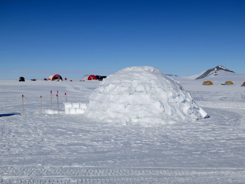
The igloo: this was built around New Year's day by the staff. It is remarkably cosy inside.
| 2013-01-05 17:02 UTC |
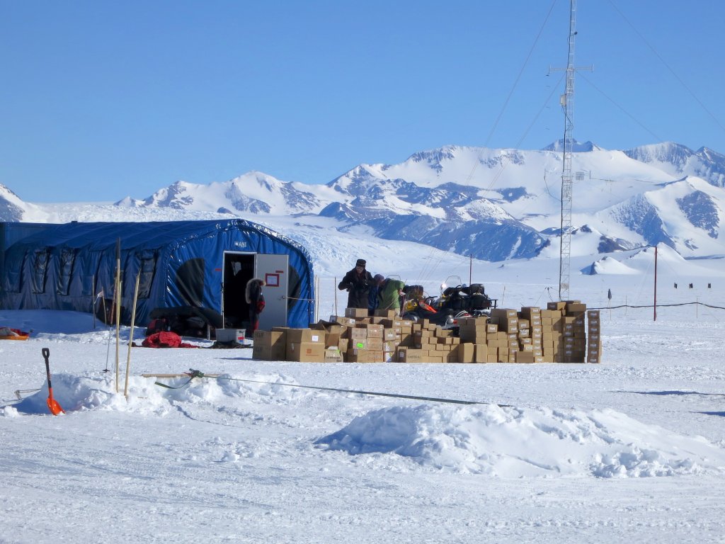
This pile of logistics was delivered with our IL-76 flight in. These are hauled from the ice runway on a sledge, then stored in the various depôts shown below.
| 2013-01-06 14:56 UTC |
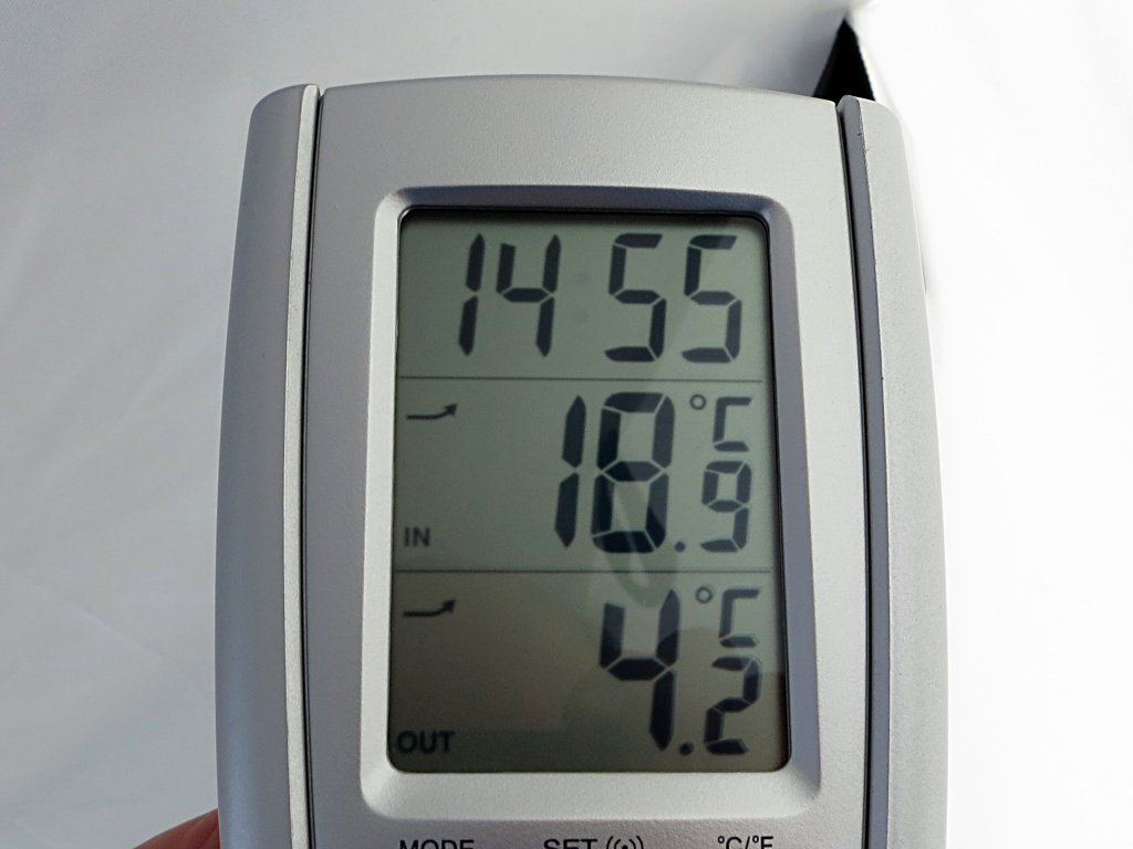
Clam tents can be surprisingly warm, although the temperature inside depends upon the angle of the Sun, cloud cover, and the wind. Inside the sleeping bags, we were never cold. The outside sensor was in the Sun when this picture was taken and read high. Throughout our stay on the glacier, the outside temperature was usually between −5° and −10° C.
| 2013-01-05 14:56 UTC |
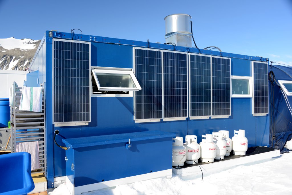
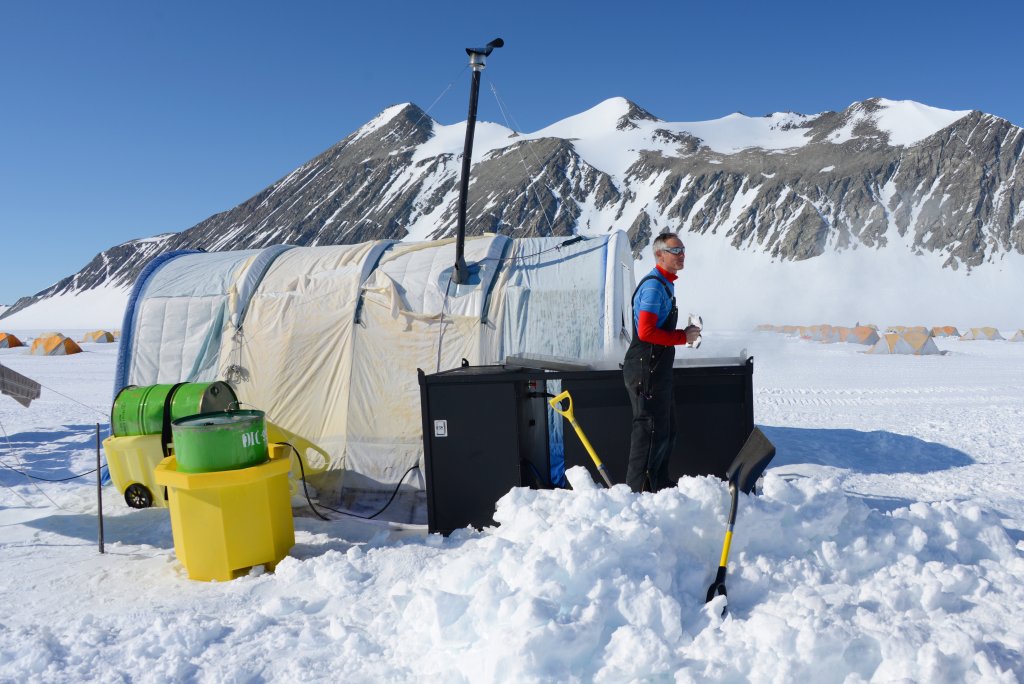
Solar power provides all electricity (the fact that the Sun never sets in summer simplifies things) and gas provides other heat. Solar panels are often placed on all sides of buildings, as the Sun just goes around and around in the sky.
| 2013-01-05 14:57 UTC |
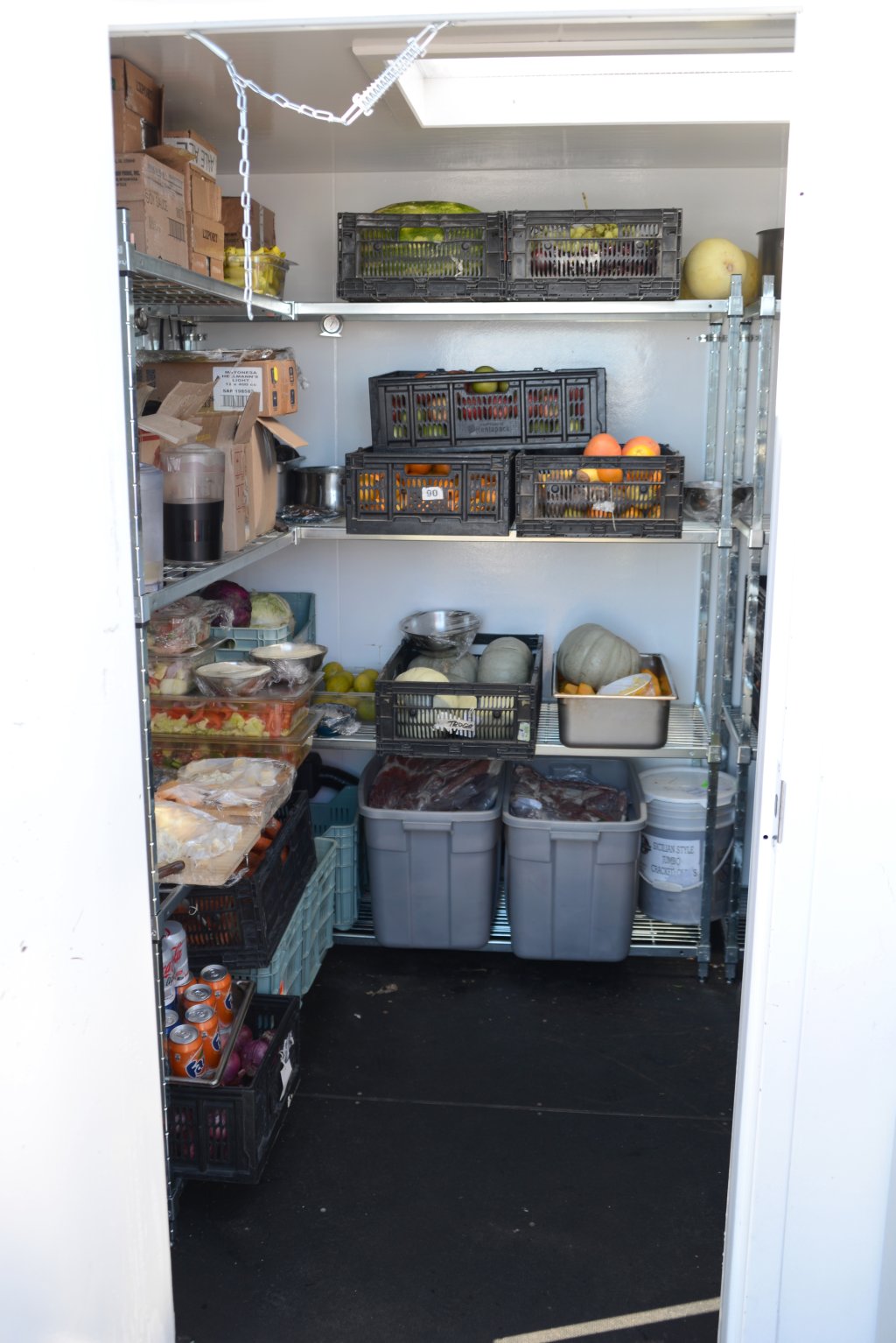
This is the locker for fresh food, kept inside a container. You know you're in Antarctica when you have to heat the “fridge” to keep things from freezing. This annex to the mess tent uses waste heat from the tent to maintain a temperature a few degrees above freezing.
| 2013-01-05 15:02 UTC |
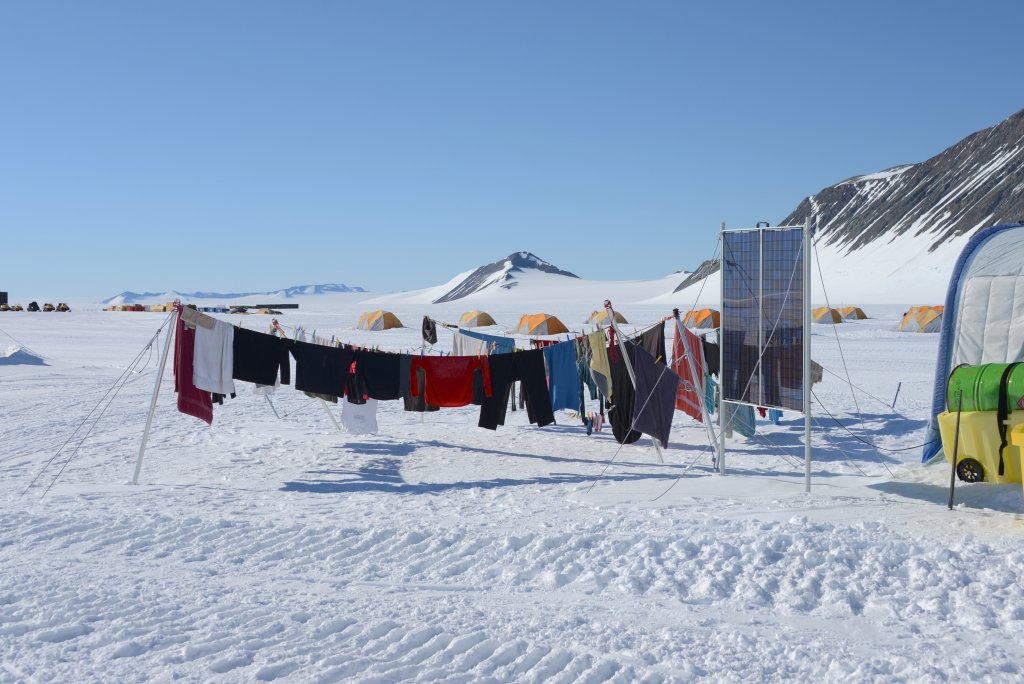
Sublimation works as well as evaporation for drying laundry!
| 2013-01-05 15:02 UTC |
This is the deepest, darkest secret of Union Glacier Camp: the tent in which the staff have their severely rationed showers. No showers for visitors, though there's a rumour there may be such decadence in the future. The Doctor was filling up the ice melter when I took this picture. I was about to explore further, but then there was something involving a sonic screwdriver and I don't remember any more of the incident.
| 2013-01-05 15:10 UTC |
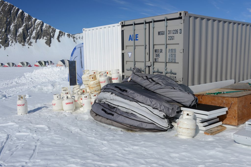
Every fall, all of the assets of the camp are packed into containers for redeployment the following spring. The bags outside this container will hold the clam tents. The empty gas bottles will be mostly evacuated by air in the last flights of the season.
| 2013-01-05 15:12 UTC |
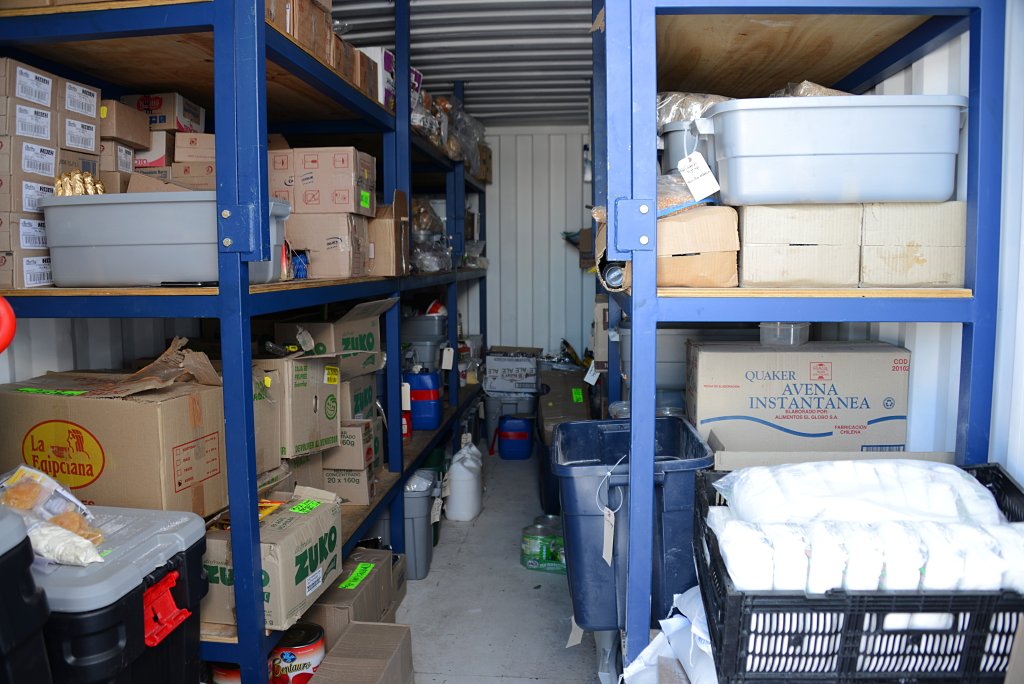
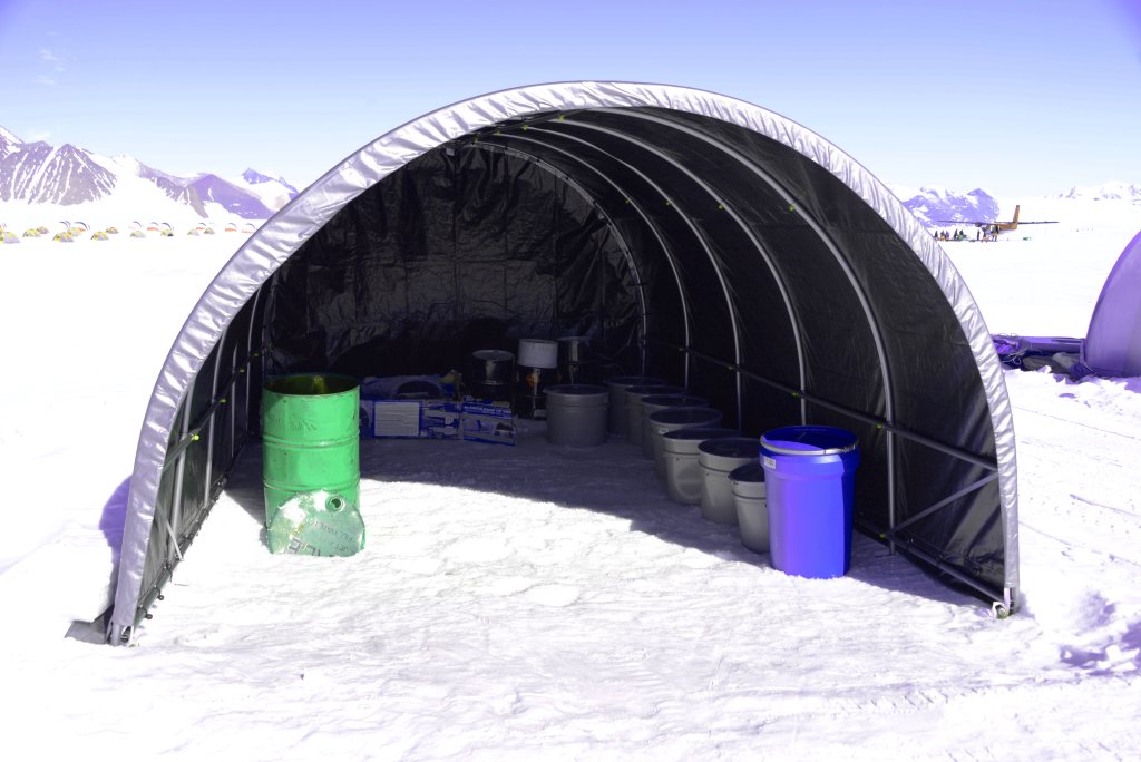
Temperature-insensitive logistics are kept in this container.
| 2013-01-05 15:14 UTC |
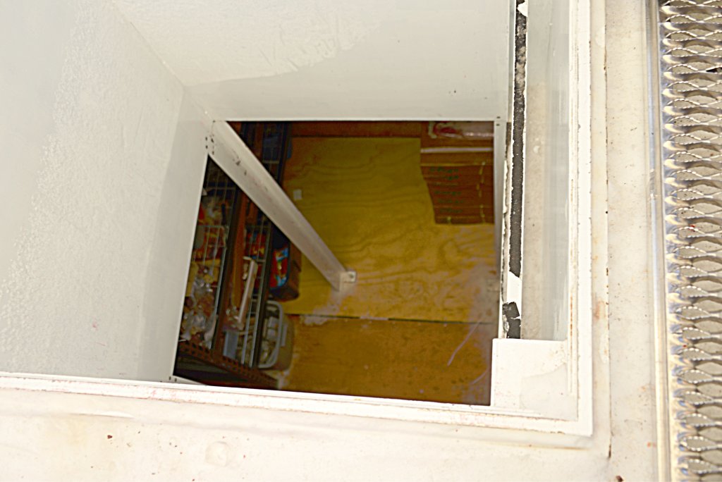
The “deep freeze” is both deep and frozen—it is a container entirely buried in the ice, accessed by a ladder and crane from a hut on the surface. It actually started out nearer the surface, but has migrated beneath the ice due to accumulation of snow and ice over the years.
| 2013-01-05 15:22 UTC |
While guests stay in clam tents, staff accommodations are the more austere tents in the foreground. These are the same tents used at the South Pole camp.
| 2013-01-05 15:23 UTC |
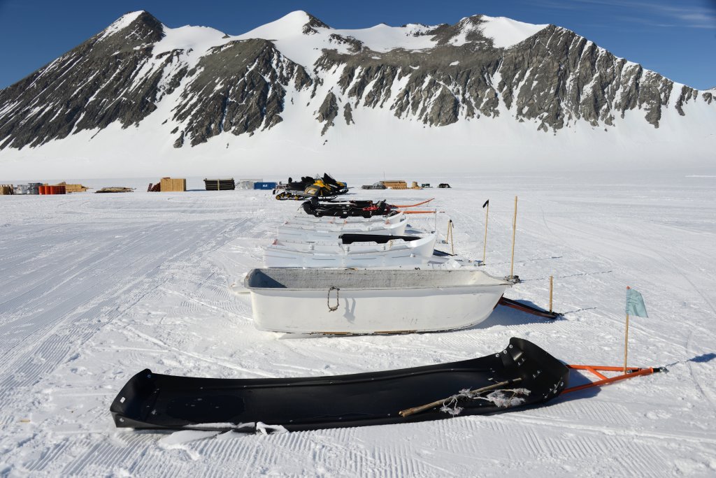
These sledges are used for hauling cargo, most often towed by snow machines.
| 2013-01-05 15:25 UTC |
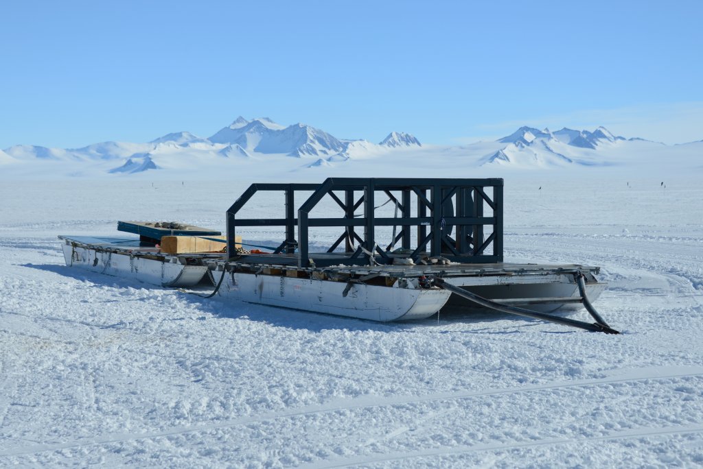
This monster sledge (called “the pontoon”), is used for large cargo transport, such as moving fuel from Union Glacier to the Thiel Mountains refuelling base (a trip which takes about two weeks each way). In one blizzard, it was buried and had to be found by ground penetrating radar. Antarctic weather can turn on you in a moment—you must always be prepared for the worst.
| 2013-01-05 15:25 UTC |
The essence of the Antarctic Treaty is “two feet bad, unless you're a penguin”. Humans must leave nothing, not even their excreta, on the frozen continent. Here is the poop tent, where the bags from the toilets are kept pending air evacuation to Chile. To the right, passengers are boarding one of the Twin Otter aircraft. Heck, so doctrinaire are the enviro fanatics that in 1994 they banned dogs from the continent. Imagine—a continent without dogs—the selfsame continent which was explored only through the exertions of those noble companions and tireless pullers of sledges! The only species we observed in the interior of Antarctica were Homo sapiens and whatever gut parasites and microbiome accompanied us. I mean, couldn't the people who winter over at the Pole have a mascot dog?
| 2013-01-11 12:11 UTC |
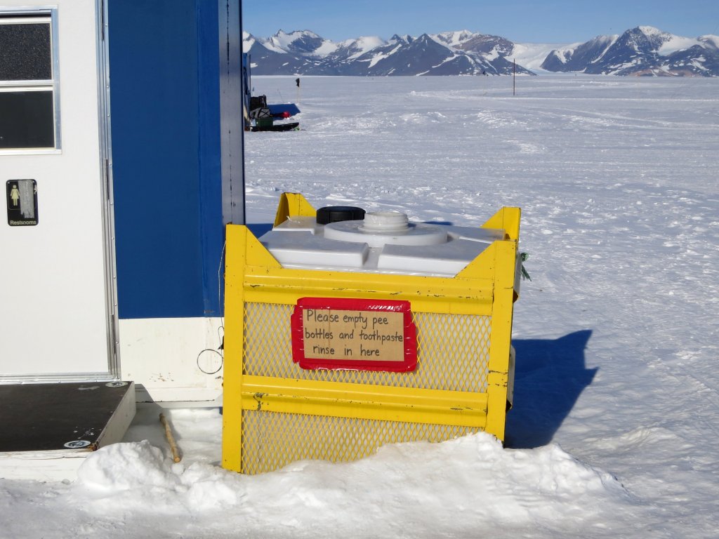
And here's the pee bottle depository: also flown out for disposal.
| 2013-01-05 15:38 UTC |
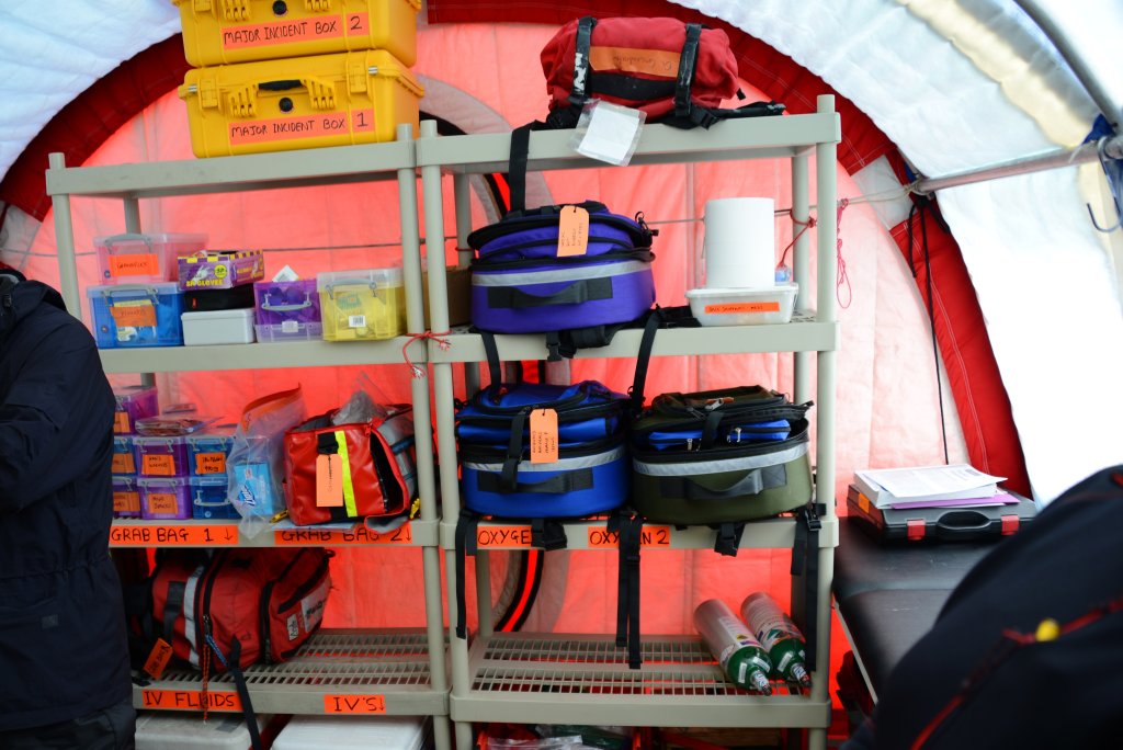
The doctor's tent maintains an inventory of around 7000 items, many with expiry dates. In case of medical problems, the focus is on stabilising the condition awaiting evacuation, but rescue of severely injured people in climbing parties and those crossing the ice is provided for and regularly rehearsed.
| 2013-01-05 15:50 UTC |
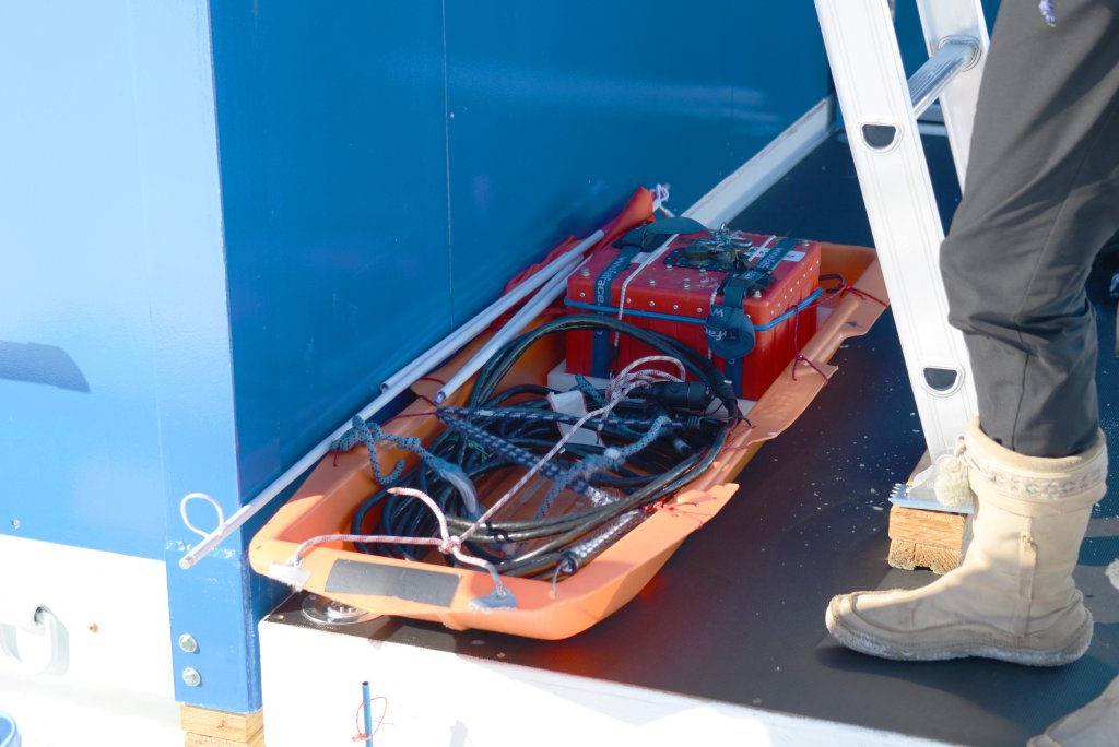
Every season, the traverses from the camp to destinations on the glacier are surveyed with this ground penetrating radar unit to ensure they are free of crevasses. There are few crevasses in the middle of the glacier (although you never know), but as you get to the edges, where friction with the mountains retards the flow of the ice, they are abundant. The surveyed routes are marked by flags, and vehicles stay close to these routes on all traverses.
| 2013-01-05 14:42 UTC |
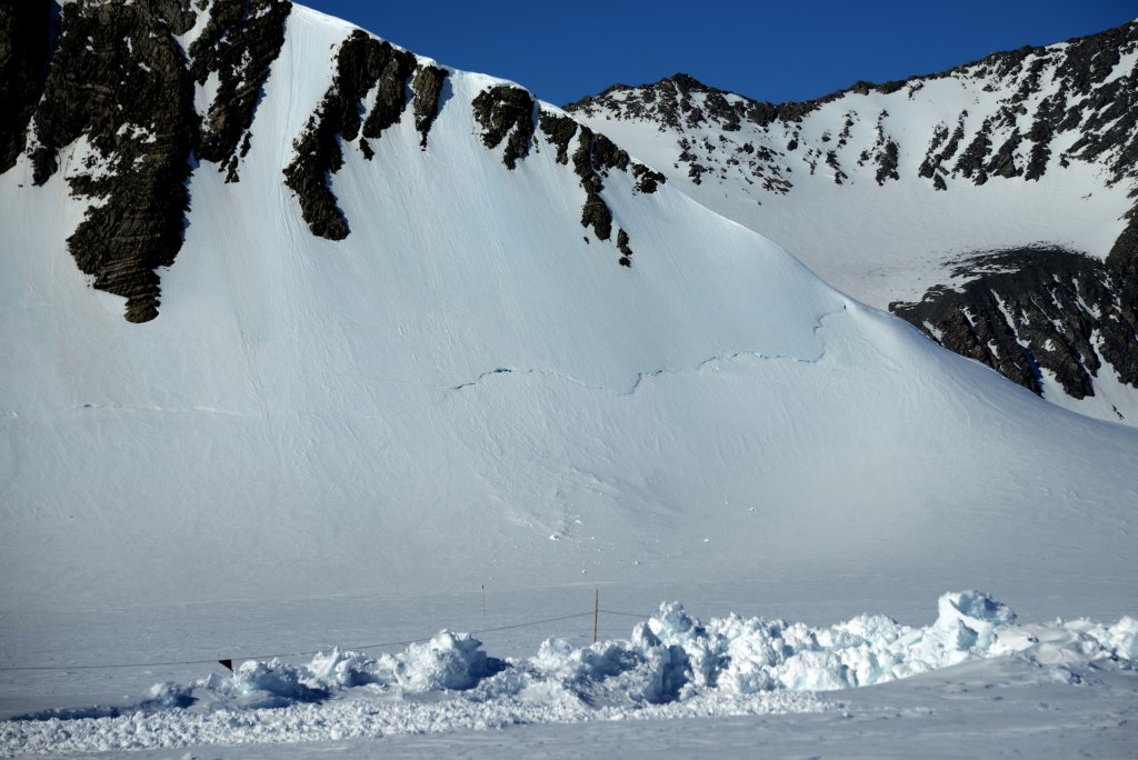
On the slope of Mount Rossman facing the camp, a well-defined bergschrund can be seen. This is a crevasse which forms when flow of the glacier (here, moving from right to left) entrains ice or snow on the slope of a mountain and causes it to separate from ice higher on the slope. Bergschrunds are visible on many peaks which border Union Glacier.
| 2013-01-05 14:58 UTC |
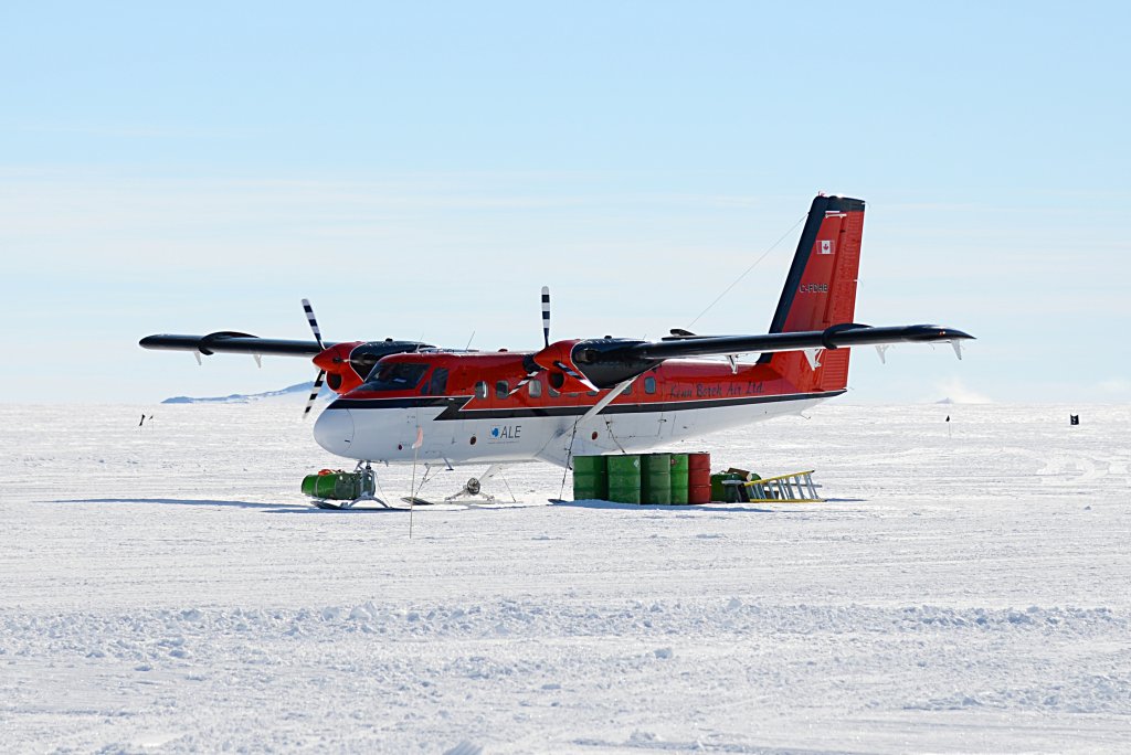
Two de Havilland Canada DHC-6 Twin Otter aircraft operate from the skiway adjacent to Union Glacier Camp. Equipped with skis, they are used to ferry climbers to the base camp at Mount Vinson and skiers who wish to “ski the last degree” to their starting point sixty nautical miles from the South Pole. The Twin Otters can be used for flights to the Pole but, depending upon prevailing winds, may need to refuel at a depôt near the Thiel Mountains.
| 2013-01-07 13:26 UTC |
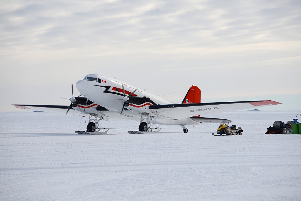
Most flights to the Pole use the Basler BT-67, a turboprop conversion of the Douglas DC-3 airframe. This particular airframe was built in 1942, although it has been extensively overhauled over its seven decades of service. When we flew to the Pole, the airplane was older than anybody on board. All of these aircraft return to Canada at the end of the season, where they operate routes in the Canadian north.
|
by John Walker February 22nd, 2013 |
|
This document is in the public domain.